GO PLACES! DO THINGS!

Along the ICE AGE FLOODS
NATIONAL GEOLOGIC TRAIL


The Ice Age Floods National Geologic Trail covers some 16,000 square miles (41,440 km2) in present day Montana, Idaho, Washington, and Oregon. We have hand picked some of the best of the best places along the Trail and present them here for you enjoy and explore! Check back often, we will be adding new and wonderful destinations for your entire Family to enjoy!

MONTANA – IDAHO – WASHINGTON – OREGON

SOME PLACES TO GO and THINGS TO DO in MONTANA

Little Money Creek Gulch Fill

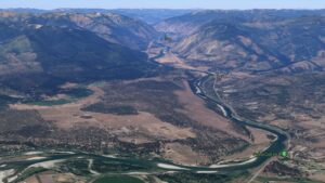
Mounds of soil, sand, gravel, and other coarse materials covered with light vegetation can be seen in the side gulches all along the Flathead River where tributaries drained into what was Glacial Lake Missoula.  They were deposited by currents eddying into the slower water in these gulches and also by the drop in velocity of the streams carrying deposits from higher elevations on the far side of the river along the path of the escaping floodwaters.  The flow of floodwaters through this narrow valley was estimated by J.T. Pardee at between 8 and 10 cubic miles per hours – more than the combined flow of all modern rivers in the world.  Similar gulch fill can be seen in many locations along this beautiful stretch of the river, which today generally flows smoothly and looks completely flat. There are numerous pull-outs along MT 200 between Perma and Paradise; the view pictured here is at mile marker 91.

Read More »

Bitterroot Valley Glacial Erratics

Two glacial erratics in the Bitterroot Valley, the Lone Rock School erratic and the Rome Lane erratic, were deposited during the last high stand of Lake Missoula about 13,000 years ago. Both these glacial erratics are easy to visit. At the extreme Southern end of the Bitterroot Valley is beautiful Lake Como named after its Italian alpine counter part by Father Ravalli a Jesuit Black Robe tasked with bringing literacy and Jesus to the native Salish people in 1845 via St Mary’s Mission in nearby Stevensville. Lake Como is a beautiful place for lunch and a hike/bike on the trail around lake including a beautiful waterfall a the head of the lake. Several mountain glaciers coalesced here and neighboring drainage to make the largest mass of ice calving into the lake south of the Flathead lobe of the Cordilleran ice sheet at Polson. This mass exited the mountains, floated into and calved into Glacial Lake Missoula. This was the primary iceberg generator for the Bitterroot Valley. As they floated out into the lake and melted they dropped large rocks called erratic onto the lake floor, which is now the surface of the valley. Lone Rock School Erratic The easiest one to find is the Lone Rock School erratic.  From Stevensville, proceed north on the Eastside Highway, county road 269, to the junction with county road 268, turn right.  Follow county road 268 until you reach the Lone Rock School on your left; the erratic is the large boulder in front of the south side of the school, and behind the fence (see map below).   The Lone Rock School erratic is 69” tall, 58” wide, 85” long, and weighs in at about 8.5 metric tons or about 18,700 lbs.  This large erratic is a type of granite called quartz monzonite.  The minerals that make up this rock type are, in order of abundance, plagioclase (calcium and/or sodium rich) feldspar, orthoclase (potassium rich) feldspar, biotite (dark mica), and quartz.  If you look closely you will see that the quartz typically stands out in relief with respect to the other minerals and that its surface has been polished to a smooth finish.  This is the result of dense glacial ice grinding over the surface of the rock. Rome Lane Erratic The Rome Lane erratic measures 47” tall, 117” long, 96” wide, and weighs in at about 13 metric tons or about 28,600 lbs.  The Rome Lane erratic is almost identical to the Lone Rock School erratic; it to is quartz monzonite granite with approximately the same minerals and mineral proportions.  The observation that both erratics are of similar rock type suggests that they came from a similar source region.  There are sources of quartz monzonite granite in both the Sapphire and Bitterroot Mountains, which is the source of these erratics?  Since we know that the erratics were carried to the shores of glacial Lake Missoula by glaciers, we can rule out the Sapphires as a possible source because we know that no glaciers in the Sapphire Mountains ever reached the shores of Lake Missoula.  So, the erratics had to come from the Bitterroot Mountains where the quartz monzonite granite lies anywhere between 5 and 20 miles from the ancient shoreline of Lake Missoula.  That means glaciers carried the erratics for distances of up to 20 miles (32.2 km) before reaching the shores of glacial Lake Missoula.  Which at an average velocity of 5 meters per day (normal for most valley glaciers with the exception of rare bursts in velocity up to 75 meters per day) would take about 18 years.  Which Erratic is Oldest? The quartz grains on the surfaces of the Rome Lane erratic are polished to a smooth shine and stand out in relief above the other minerals, similar to the Lone Rock School erratic.  However, the quartz grains exposed on the top surface of the Rome Lane erratic seem to exhibit higher relief than the quartz grains exposed on any other side of the Rome Lane erratic and/or the top surface of the Lone Rock School erratic.  Why is this?  Rainwater is slightly acidic and acidic fluids can break down some minerals, such as feldspar, and turn them into clay.  Quartz, however, is very resistant to acidic fluids and as a result takes longer to break down or weather.  It is this difference in weathering rates between feldspar and quartz that causes the quartz grains to stand higher than the feldspar grains.  So, based on this relationship we can say that the greater the relief between quartz and feldspar on a rock surface, the longer that surface has been exposed to the elements i.e. rain and wind.  With that in mind, which erratic’s top surface has been exposed longer?  If you answered Lone Rock, you are correct.  As it turns out the Lone Rock School erratic was dug up and moved from its original location, about ¾ of a mile to the south of where it sits today, to commemorate the Lone Rock Schools’ centennial in 1985, in fact upon its excavation portions of the erratic broke off and remain buried.  So what is the top surface of the Lone Rock School erratic today may well not have been the top surface before 1985, and our mineral weathering hypothesis fits the facts. 

Read More »

Eddy Narrows

Eddy Narrows Ice Age Floods National Geologic Trail Eddy Narrows is a 10-mile long canyon between Plains and Thompson Fall along the Clark Fork River. Here all of the waters from the northern and eastern arms of Glacial Lake Missoula converged and picked up speed as they were forced through this restricted area. The steep valley walls are bare of talus and soils up to the level estimated to be the highest level of the lake (1000 ft), and there are polished grooves in the bedrock on a bench 340-400 feet above the Clark Fork River that run parallel to it. Since there is no evidence of glaciation in this area, the only explanation is the rapid draining of Glacial Lake Missoula. Using the dimensions of this flume-shaped area of the canyon, which controlled the rate of flow of water surging through it, in 1942 J.T. Pardee was able to calculate maximum speeds approaching 80 mph, emptying Glacial Lake Missoula in as little as three days. There are pullouts along MT-200 at either end of the narrowest part of this section marked for observing big horn sheep with Glacial Lake Missoula signage at the one between mileposts 59 and 60 at: 47.537940, -115.071654  Quick Facts Location:Between Plains and Thompson Falls, MT 

Read More »
SOME PLACES TO GO and THINGS TO DO in IDAHO

Green Monarch Ridge

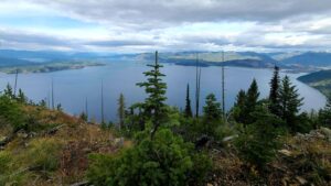
Green Monarch Ridge Ice Age Floods National Geologic Trail THIS IS WHERE IT ALL BEGAN! The Green Monarch Ridge viewpoint, just south of the Hope Fault, is positioned along the edge of the Purcell Trench Ice Lobe. Here it was responsible for damming the mouth of the Clark Fork drainage basin. This damming effect resulted in the formation of Glacial Lake Missoula, the source of the waters for much of  the PNW Pleistocene Ice Age Floods. The Purcell Trench Ice Lobe originated in Canada and flowed south into Idaho, guided by the structural control of the Purcell Trench. Following the path of least resistance into the basin now occupied by Lake Pend Oreille, it was impeded by the Green Monarch Ridge, located approximately 10 miles south of this viewpoint. Grinding and scraping, the Purcell Trench Ice Lobe backed up behind the Green Monarch Ridge, eventually building an ice plug up to 4,000 feet thick, and scouring out the deepest parts of Lake Pend Oreille. The Purcell Trench Ice Lobe divided into four sub-lobes: one went approximately west (US Highway 2), two went south (US Highway 95 and Lake Pend Oreille) and one went east (SR 200). All four sub-lobes contributed to blocking the Clark Fork drainageQuick Facts MANAGED BY:US Forest Service – Idaho Panhandle National Forest

Read More »

Clark Fork Ice Dam

Ice Age Floods National Geologic Trail 12,000 to 17,000 years ago a 4000′ tall ice dam blocked the path of the Clark Fork River creating glacial Lake Missoula. At the end of the last ice age this ice dam failed, releasing more water than is held in modern day Lake Ontario and Lake Erie combined. 600 cubic miles of water rushed through this area and down Lake Pend Oreille destined for the Pacific Ocrean.One of the most intriguing questions about the catastrophic flooding is how the ice dam failed. Various mechanisms for glacial outburst floods have been proposed: Ice erosion by overflow water, subglacial failure by flotation, deformation of ice by water pressure, and erosion of subglacial tunnels by flowing water. One model suggests a self-dumping phenomenon. In this mechanism, floodwaters are released when the lake level reaches nine-tenths the height of the ice. At this depth the ice becomes buoyant, subglacial tunnels form and enlarge, and drainage occurs until hydrostatic pressure is decreased and the ice again seals the lake. The self-emptying model is used to explain the numerous cycles in the rhythmite deposits and to interpret each cycle as a separate flood. Even so, only the total collapse of the ice dam can explain the largest of the catastrophic foods. Sub-glacial tunneling and enlargement due to thermal erosion progressing to collapse have also been proposed, as well as catastrophic failure due to water pressure. All are dependent on the configuration of the ice dam and structure of the ice. Quick Facts Location:Clark Fork, Idaho

Read More »

Museum of North Idaho

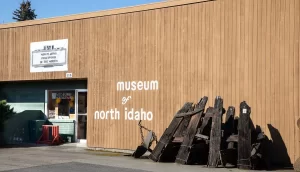
Museum of North Idaho IceAgeFloods National GeologicTrail “The Museum of North Idaho collects, preserves and interprets the history of the Coeur d’Alene Region. to foster appreciation of the area’s heritage.” In the 1960s, the North Idaho Hoo Hoo Club, an organization of loggers, lumbermen and foresters, first entertained the idea of establishing a museum. They incorporated on May 1, 1968 for a museum focusing on the history of the Coeur d’Alene Region (Kootenai, Benewah and part of Shoshone counties). Through the efforts of volunteers and community support, the Museum opened its doors on the North Idaho College campus on July 28, 1973. In 1979, they remodeled a City-owned building and relocated to its current location. Quick Facts Location: 115 Northwest Blvd, Coeur d’Alene, ID 83814Phone: (208) 664-3448 The Museum is open Tuesday to Saturday from 11 am – 5 pm.

Read More »
SOME PLACES TO GO and THINGS TO DO in WASHINGTON

Grand Coulee Dam Visitor Center

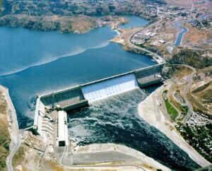
Grand Coulee Dam Visitor Center Ice Age Floods National Geologic Trail | Columbia Basin Project The Columbia Basin Project, which includes Grand Coulee Dam as its main feature, is the Bureau of Reclamation’s largest multipurpose project. Grand Coulee Dam includes three major hydroelectric power generating plants

Read More »

Postmortem on the southern Cordilleran Ice Sheet

(21Feb2024) On 18 March 2924 at 7:00pm the Puget Lobe Chapter io the IAFI will have Dr Ralph A Haugerud give his presentation “the Postmortem on the Southern Cordilleran Ice sheet.  Death of an ice sheet can have many causes, as shown by retreat of

Read More »

Yakima Sportsman State Park

Yakima Sportsman State Park Ice Age Floods National Geologic Trail Yakima Sportsman State Park is, literally, an oasis in the desert. Located near the urban amenities of Yakima in arid eastern Washington, this park attracts local picnickers, out-of-town visitors and road-trippers passing through. Birds flock

Read More »
SOME PLACES TO GO and THINGS TO DO in OREGON

Crown Point National Natural Landmark

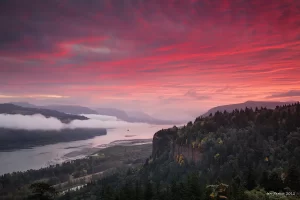
Crown Point National Natural Landmark Ice Age Floods National Geologic Trail – Historic Columbia River Highway This spectacular viewpoint along the Historic Columbia River Highway 30 was the site of the 1916 dedication of a highway that was, for that time, an innovative European-style road

Read More »

Multnomah Falls and Lodge

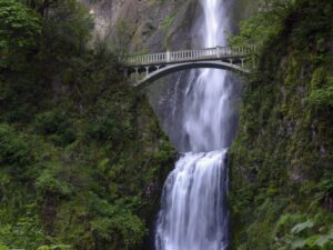
Multnomah Falls and Lodge Ice Age Floods National Geologic Trail, Lewis & Clark National Historic Trail Oregon’s tallest waterfall (620 ft.) is just 30 minutes east of Portland and 30 minutes west of Hood River. Offering scenic splendor and a gateway to the Gorge’s Waterfall Corridor,

Read More »

Museum of Natural History, University of Oregon

Museum of Natural and Cultural History, University of Oregon The museum offers a variety of seasonal and year-round programs for science and culture enthusiasts of every age. Delve into Oregon’s story, from the archaeology of the First Americans to the dynamic cultures of today’s Tribes.

Read More »
Even MORE PLACES TO GO and THINGS TO DO

Click a STATE for MORE PLACES TO GO and THINGS TO DO

MONTANA – IDAHO – WASHINGTON – OREGON

Share this article:

Like this:

Like Loading…