GO PLACES! DO THINGS!

Along the ICE AGE FLOODS
NATIONAL GEOLOGIC TRAIL


The Ice Age Floods National Geologic Trail covers some 16,000 square miles (41,440 km2) in present day Montana, Idaho, Washington, and Oregon. We have hand picked some of the best of the best places along the Trail and present them here for you enjoy and explore! Check back often, we will be adding new and wonderful destinations for your entire Family to enjoy!

MONTANA – IDAHO – WASHINGTON – OREGON

SOME PLACES TO GO and THINGS TO DO in MONTANA

Little Money Creek Gulch Fill

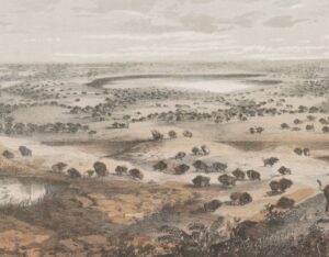
Mounds of soil, sand, gravel, and other coarse materials covered with light vegetation can be seen in the side gulches all along the Flathead River where tributaries drained into what was Glacial Lake Missoula.  They were deposited by currents eddying into the slower water in these gulches and also by the drop in velocity of the streams carrying deposits from higher elevations on the far side of the river along the path of the escaping floodwaters.  The flow of floodwaters through this narrow valley was estimated by J.T. Pardee at between 8 and 10 cubic miles per hours – more than the combined flow of all modern rivers in the world.  Similar gulch fill can be seen in many locations along this beautiful stretch of the river, which today generally flows smoothly and looks completely flat. There are numerous pull-outs along MT 200 between Perma and Paradise; the view pictured here is at mile marker 91.

Read More »

Bison Range

Bison Range The Bison Range was established by President Theodore Roosevelt in 1908 to conserve the American Bison.  Since that time it has been managed as a wildlife refuge and native grassland. Today the management is done by the Confederated Salish and Kootenai Tribes. The range is a small, low-rolling mountain connected to the Mission Mountain Range by a gradually descending spur. Range elevation varies from 2,585 feet (788 m) at headquarters to 4,885 feet (1,489 m) at High Point on Red Sleep Mountain, the highest point on the Range.  Much of the Bison Range was once under prehistoric Glacial Lake Missoula. The upper part of the Range was above water. Red Sleep Mountain scenic drive leads to this high point, which has spectacular views across what was once the lake to the Mission Mountains on the other side.  Other flood features are evident on Buffalo Prairie scenic drive. Old beach lines (strandlines) can be seen on north-facing slopes and some large erratics are located near the old corrals. There is a visitor center near the entrance which has a display and videos of Glacial Lake Missoula as well as information on the tribes of the Flathead Reservation and the abundant wildlife, including birds, bears and antelope.  There is also a gift shop.  Camas Prairie ripples and several other important features of Glacial Lake Missoula are in close proximity to this site, much of them are located on tribal lands.  The entrance is off US 93 and MT 212 N about an hour north of Missoula. Bison Range58355 Bison Range Rd, Moiese, MT (406) 644-2661 bisonrange.org FEES – there is a fee for entrance, including the day use area, except for CSKT tribal members OPEN HOURSWinter Hours (Nov-April)Gate: 8am–6pmVisitors Center: 8am–5pm Red Sleep Drive: closed Buffalo Prairie Drive: 8am-6pm Summer Hours (May-Oct)Gate: 7am–8pmVisitors Center: 8am–7pm Red Sleep Drive: 8am–7pm Buffalo Prairie Drive:8am–8pm  Restrictions: Vehicles over 30 feet long and those owing trailers as well as motorcycles, ATVs, and bicycles are not allowed on either drive.  Visitors must remain inside vehicles at all times except for designated areas      

Read More »

Travelers’ Rest State Park

Travelers’ Rest State Park Ice Age Floods National Geologic Trail Located at an historic and contemporary crossroads, Travelers’ Rest State Park and National Historic Landmark is a place where visitors can say with certainty that they are walking in the footsteps of Lewis and Clark. The Park is at the core of a campsite used by the Corps of Discovery from September 9 – 11, 1805 and again from June 30 – July 3, 1806. In the summer of 2002, archaeologists uncovered evidence of the Corps of Discovery’s visit to the area, including a trench latrine tainted with mercury, fire hearths, and lead used in the repair and manufacture of firearms. The discovery makes Travelers’ Rest the only campsite on the Lewis and Clark Trail with physical evidence of the expedition. For centuries Native Americans also used the area as a campsite and trail junction. Salish, Pend d’Oreille and Nez Perce peoples were among those who traditionally occupied the area. Native American storytellers bring their history, culture and society to life as part of the programming at Travelers’ Rest State Park. The Bitterroot River is the primary body of water in this area, now running about 500 feet below the surface of what was once Glacial Lake Missoula, which extended all the way to the area now indicated by a high water marker at Lake Como.  There are few vestiges of the Lake in this area but information and a display are located at the Visitor Center. Travelers’ Rest is an idyllic spot for strolling the park’s trails, and offers a rich bird habitat, with more than 115 species recorded within the park boundaries. Quick Facts Location:Located 1/2 mile west of Lolo on Hwy 12 Significance:Located at the crossroads of culture, this is the only archaeologicaly verified campsite of the Lewis and Clark Expedition, as well as the traditional homeland of the Selis Qlispe people. Designation:National Historic Landmark 

Read More »
SOME PLACES TO GO and THINGS TO DO in IDAHO

Lake Pend Oreille

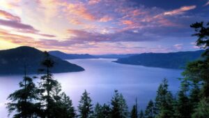
Lake Pend Oreille Ice Age Floods National Geologic Trail  The Purcell Lobe of the Cordilleran Ice Sheet repeatedly formed a 2000′ tall ice dam in this area, which backed up Glacial Lake Missoula and eventually burst catastrophically, releasing Ice Age Floods as often as about every ~10-60 years. Lake Pend Oreille is the largest lake in Idaho. The lake level is 2062 ft above sea level, with the surrounding terrain as high as 6002 ft. With a maximum depth of 1150 ft, this lake is the 5th deepest in the US. The location of the lake is probably related to an old river valley controlled by faults. The Lake Pend Oreille basin was carved by the repeated advances of Pleistocene ice and scoured by Ice Age Floods. With the waning of flood waters, the basin was filled with glacial out-wash and flood deposits. The lake is dammed at the south end by thick glacial and flood deposits that mark the beginning of the “Outburst Deposits”Quick Facts MANAGED BY:US Forest Service

Read More »

Farragut State Park

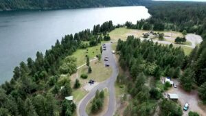
Farragut State Park Ice Age Floods National Geologic Trail Farragut State Park is located at the “breakout” of Glacial Lake Missoula floods, where the ice dam in the Clark Fork valley and the 20-mile-long tongue of ice occupying the Lake Pend Oreille basin failed. From there, a torrent of water and ice burst from the south end of the lake. Farragut State Park is located at the “breakout” of Glacial Lake Missoula floods. Failure of the ice dam in the Clark Fork valley fractured and broke apart the 20-mile-long tongue of ice occupying the Lake Pend Oreille basin, and a torrent of water and ice burst from the south end of the lake. That churning slurry of flood waters, ice, boulders and other debris erupted from the south end of Lake Pend Oreille, flowing 2000 ft deep across Farragut State Park. Nearly all of the water escaping from Glacial Lake Missoula passed through this area. Discharge estimates range from 14 to 21 million cubic meters per second! Vic Baker’s definition of a megaflood is one which has a discharge of at least 1mil cubic m/s, so we are possibly looking at ground zero for the worst Pleistocene flood in the world. Farragut State Park includes many geologic features left by glaciation and megafoods.Hoodoo channel, an abandoned outlet of Lake Pend Oreille provided a pathway for late-glacial meltwater and for the last outbursts from Glacial Lake Missoula. The channel is marked with a number of closed depressions, probably the result of melting icebergs. One of the largest of these features have been proposed, including kettles, potholes, and sub-glacial meltwater. Some of that debris was deposited to form the Rathdrum Prairie Outburst Plain, an extensive, heterogeneous mix of flood deposits. Farragut State Park offers unique scenery, history and an abundance of recreational opportunities. Quick Facts Location:13550 E. Hwy 54 Athol, ID 83801 

Read More »

Green Monarch Ridge

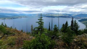
Green Monarch Ridge Ice Age Floods National Geologic Trail THIS IS WHERE IT ALL BEGAN! The Green Monarch Ridge viewpoint, just south of the Hope Fault, is positioned along the edge of the Purcell Trench Ice Lobe. Here it was responsible for damming the mouth of the Clark Fork drainage basin. This damming effect resulted in the formation of Glacial Lake Missoula, the source of the waters for much of  the PNW Pleistocene Ice Age Floods. The Purcell Trench Ice Lobe originated in Canada and flowed south into Idaho, guided by the structural control of the Purcell Trench. Following the path of least resistance into the basin now occupied by Lake Pend Oreille, it was impeded by the Green Monarch Ridge, located approximately 10 miles south of this viewpoint. Grinding and scraping, the Purcell Trench Ice Lobe backed up behind the Green Monarch Ridge, eventually building an ice plug up to 4,000 feet thick, and scouring out the deepest parts of Lake Pend Oreille. The Purcell Trench Ice Lobe divided into four sub-lobes: one went approximately west (US Highway 2), two went south (US Highway 95 and Lake Pend Oreille) and one went east (SR 200). All four sub-lobes contributed to blocking the Clark Fork drainageQuick Facts MANAGED BY:US Forest Service – Idaho Panhandle National Forest

Read More »
SOME PLACES TO GO and THINGS TO DO in WASHINGTON

Scooteney Reservoir

Scooteney Reservoir Ice Age Floods National Geologic Trail Situated about nine miles southeast of Othello, west of Highway SR-17, this body of water has a year-round open fishing season. Smallmouth Bass, Largemouth Bass, Walleye, Bluegill sunfish, crappie, and Yellow Perch produce good action throughout the

Read More »

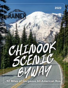
Chinook Scenic Byway

The Chinook Scenic Byway is recognized as a premier driving tour in Washington State.  The byway travels through the Mt. Baker-Snoqualmie National Forest and Mount Rainier National Park. Experience the diverse landscape of the Central Cascades, from Enumclaw and the glacier-fed White River Valley to

Read More »
SOME PLACES TO GO and THINGS TO DO in OREGON

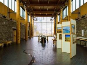
Columbia Gorge Discovery Center & Museum

Columbia Gorge Discovery Center & Museum Ice Age Floods National Geologic Trail, Lewis & Clark National Historic Trail, Oregon National Historic Trail The Columbia Gorge Discovery Center & Museum is located on a 54-acre point of land adjacent to the Columbia River and is the

Read More »

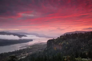
Crown Point National Natural Landmark

Crown Point National Natural Landmark Ice Age Floods National Geologic Trail – Historic Columbia River Highway This spectacular viewpoint along the Historic Columbia River Highway 30 was the site of the 1916 dedication of a highway that was, for that time, an innovative European-style road

Read More »

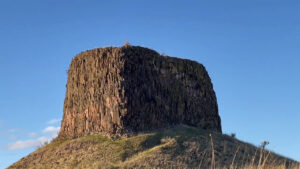
Hat Rock State Park

Hat Rock State Park Ice Age Floods National Geologic Trail, Lewis & Clark National Historic Trail Hat Rock is an erosion remnant warn way by floods from glaciers which melted over ten thousand years ago. Lewis and Clark saw this monument on their expedition and

Read More »
Even MORE PLACES TO GO and THINGS TO DO

Click a STATE for MORE PLACES TO GO and THINGS TO DO

MONTANA – IDAHO – WASHINGTON – OREGON

Share this article:

Like this:

Like Loading…