GO PLACES! DO THINGS!

Along the ICE AGE FLOODS
NATIONAL GEOLOGIC TRAIL


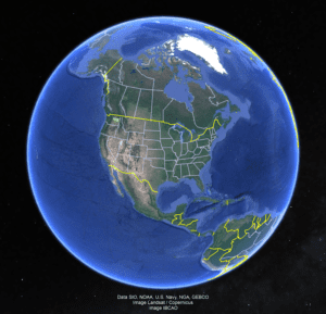
The Ice Age Floods National Geologic Trail covers some 16,000 square miles (41,440 km2) in present day Montana, Idaho, Washington, and Oregon. We have hand picked some of the best of the best places along the Trail and present them here for you enjoy and explore! Check back often, we will be adding new and wonderful destinations for your entire Family to enjoy!

MONTANA – IDAHO – WASHINGTON – OREGON

SOME PLACES TO GO and THINGS TO DO in MONTANA

Montana Natural History Center

Montana Natural History Center Ice Age Floods National Geologic Trail  The mission of the Montana Natural History Center is to promote and cultivate the appreciation, understanding, and stewardship of nature through education. Founded in 1991, MNHC was the brainchild of a group of educators who were involved in various efforts to educate both kids and adults about the natural history of western Montana, and who decided to unite those efforts into one environmental education organization. MNHC provides nature education programming for people of all ages through summer camps, kids’ activities, Visiting Naturalist in the Schools, Master Naturalist certification courses and Field Days, evening programs, Field Notes on Montana Public Radio, museum tours, and more.  We have a variety of exhibits that focus on the flora, fauna, geology, and ecology of our beautiful state. Please stop by and visit! MNHC often partners with the Ice Age Floods Institute to share fields trips and lectures about the Ice Age Floods.   MNHC has exhibits that help visitors explore the Glacial Lake Missoula and Ice Age Floods. Learn more at:Explore Glacial Lake Missoula | Montana Natural History Center (montananaturalist.org) The Glacial Lake Missoula Chapeter of the Ice Age Floods Institue also produced a short movie about Glacial Lake Missoula. You can find a link here. Quick Facts Location:120 Hickory Street, Suite A, Missoula, Montana

Read More »

Little Money Creek Gulch Fill

Mounds of soil, sand, gravel, and other coarse materials covered with light vegetation can be seen in the side gulches all along the Flathead River where tributaries drained into what was Glacial Lake Missoula.  They were deposited by currents eddying into the slower water in these gulches and also by the drop in velocity of the streams carrying deposits from higher elevations on the far side of the river along the path of the escaping floodwaters.  The flow of floodwaters through this narrow valley was estimated by J.T. Pardee at between 8 and 10 cubic miles per hours – more than the combined flow of all modern rivers in the world.  Similar gulch fill can be seen in many locations along this beautiful stretch of the river, which today generally flows smoothly and looks completely flat. There are numerous pull-outs along MT 200 between Perma and Paradise; the view pictured here is at mile marker 91.

Read More »

Glacial Lake Missoula Strandlines

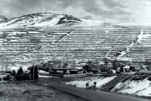
Glacial Lake Missoula Strandlines Ice Age Floods National Geologic Trail Imagine you are standing on the edge of glacial Lake Missoula 15,000 years ago. You can hear lapping waves cutting benches known as “strand-lines” into the shoreline. Today, you can see these huge strand-lines on hills surrounding Missoula, Montana, marking changes in lake level over time. On Mount Sentinel, marked with an “M”, and Mount Jumbo, marked with an “L”, the strand-lines are seen as horizontal lines in the vegetation or highlighted by snow in the winter. Public hiking trails switchback through the strand-lines on Mount Sentinel and Mount Jumbo. Ancient shorelines or strand-lines of Glacial Lake Missoula are visible as perfectly parallel horizontal benches on hillside slopes around Missoula. They are most visible with light snow cover, or in low evening light on the mountains marked with an”M” and an “L” on either side of Hellgate Canyon looking east from the downtown.  These shoreline benches cut by wave action in the lake recorded various lake levels as the ice dam blocking the Clark Fork River far upstream on the Idaho border repeatedly failed and refilled 40 times or more.  It may be that as the ice-age waned each successive ice dam that reformed was smaller and failed under less pressure from a lower lake level than the one before, leaving behind its bench as a record of the successively lower ancient lake shorelines. It’s also possible they record winter still-stands in rising lake levels over time.  Quick Facts Location:The Kim Williams Trail at Van Buren and 5th Street leads from the U Montana campus along the river between the mountains. To reachhigh water markers on the mountains see the Interactive Map or go to GlacialLakeMissoula.org 

Read More »
SOME PLACES TO GO and THINGS TO DO in IDAHO

Clark Fork Ice Dam

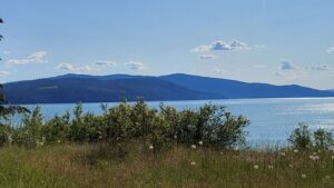
Ice Age Floods National Geologic Trail 12,000 to 17,000 years ago a 4000′ tall ice dam blocked the path of the Clark Fork River creating glacial Lake Missoula. At the end of the last ice age this ice dam failed, releasing more water than is held in modern day Lake Ontario and Lake Erie combined. 600 cubic miles of water rushed through this area and down Lake Pend Oreille destined for the Pacific Ocrean.One of the most intriguing questions about the catastrophic flooding is how the ice dam failed. Various mechanisms for glacial outburst floods have been proposed: Ice erosion by overflow water, subglacial failure by flotation, deformation of ice by water pressure, and erosion of subglacial tunnels by flowing water. One model suggests a self-dumping phenomenon. In this mechanism, floodwaters are released when the lake level reaches nine-tenths the height of the ice. At this depth the ice becomes buoyant, subglacial tunnels form and enlarge, and drainage occurs until hydrostatic pressure is decreased and the ice again seals the lake. The self-emptying model is used to explain the numerous cycles in the rhythmite deposits and to interpret each cycle as a separate flood. Even so, only the total collapse of the ice dam can explain the largest of the catastrophic foods. Sub-glacial tunneling and enlargement due to thermal erosion progressing to collapse have also been proposed, as well as catastrophic failure due to water pressure. All are dependent on the configuration of the ice dam and structure of the ice. Quick Facts Location:Clark Fork, Idaho

Read More »

Farragut State Park

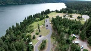
Farragut State Park Ice Age Floods National Geologic Trail Farragut State Park is located at the “breakout” of Glacial Lake Missoula floods, where the ice dam in the Clark Fork valley and the 20-mile-long tongue of ice occupying the Lake Pend Oreille basin failed. From there, a torrent of water and ice burst from the south end of the lake. Farragut State Park is located at the “breakout” of Glacial Lake Missoula floods. Failure of the ice dam in the Clark Fork valley fractured and broke apart the 20-mile-long tongue of ice occupying the Lake Pend Oreille basin, and a torrent of water and ice burst from the south end of the lake. That churning slurry of flood waters, ice, boulders and other debris erupted from the south end of Lake Pend Oreille, flowing 2000 ft deep across Farragut State Park. Nearly all of the water escaping from Glacial Lake Missoula passed through this area. Discharge estimates range from 14 to 21 million cubic meters per second! Vic Baker’s definition of a megaflood is one which has a discharge of at least 1mil cubic m/s, so we are possibly looking at ground zero for the worst Pleistocene flood in the world. Farragut State Park includes many geologic features left by glaciation and megafoods.Hoodoo channel, an abandoned outlet of Lake Pend Oreille provided a pathway for late-glacial meltwater and for the last outbursts from Glacial Lake Missoula. The channel is marked with a number of closed depressions, probably the result of melting icebergs. One of the largest of these features have been proposed, including kettles, potholes, and sub-glacial meltwater. Some of that debris was deposited to form the Rathdrum Prairie Outburst Plain, an extensive, heterogeneous mix of flood deposits. Farragut State Park offers unique scenery, history and an abundance of recreational opportunities. Quick Facts Location:13550 E. Hwy 54 Athol, ID 83801 

Read More »

Glacial Dam at Green Monarch Ridge View Point

Glacial Lobe Dam at Green Monarch Ridge View Point Ice Age Floods National Geologic Trail  As the Purcell Trench ice lobe of the Cordilleran Ice Sheet advanced south from Canada, it was stopped by the Green Monarch Ridge, building an ice dam 4,000 feet (1219 m) tall and nearly 40 miles (64 km) wide that blocked the Clark Fork river, thus filling glacial Lake Missoula. View the Green Monarch Ridge and the Purcell Trench from a large pullout on Idaho State Route 200, about one mile (1.6 km) west of Hope, Idaho and 15 miles (24 km) east of Sandpoint, Idaho. Quick Facts Location: Idaho State Route 200, about one mile west of Hope, Idaho and 15 miles  east of Sandpoint, Idaho.

Read More »
SOME PLACES TO GO and THINGS TO DO in WASHINGTON

The Bretz Journals and Google Earth

If you have been following Professor Nick Zentner (CWU) on YouTube, you may know that one of the treasures he has uncovered with the help of collaborators are the Bretz journals from field research done from 1919 through 1929. After Bretz’s death in 1981, his

Read More »

Lyons Ferry State Park

Lyons Ferry State Park Ice Age Floods National Geologic Trail If eastern Washington calls to you, Lyons Ferry State Park is sure to enthrall. Tree-shaded green lawns gracefully slope to the cooling waters of the Snake and Palouse rivers. The hills of the Palouse, on

Read More »

Palouse Falls State Park

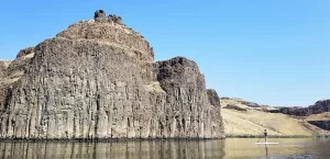
Palouse Falls State Park Ice Age Floods National Geologic Trail The Palouse River runs through a narrow cataract and drops 200 feet to a churning bowl. From there, the current moves swiftly, through a winding gorge of columnar basalt, to its southern end at the

Read More »
SOME PLACES TO GO and THINGS TO DO in OREGON

Crown Point National Natural Landmark

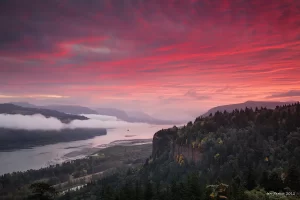
Crown Point National Natural Landmark Ice Age Floods National Geologic Trail – Historic Columbia River Highway This spectacular viewpoint along the Historic Columbia River Highway 30 was the site of the 1916 dedication of a highway that was, for that time, an innovative European-style road

Read More »

Columbia Gorge Discovery Center & Museum

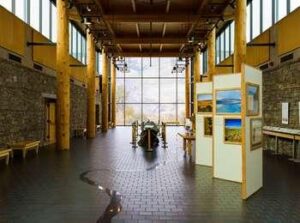
Columbia Gorge Discovery Center & Museum Ice Age Floods National Geologic Trail, Lewis & Clark National Historic Trail, Oregon National Historic Trail The Columbia Gorge Discovery Center & Museum is located on a 54-acre point of land adjacent to the Columbia River and is the

Read More »

Hat Rock State Park

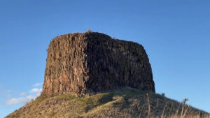
Hat Rock State Park Ice Age Floods National Geologic Trail, Lewis & Clark National Historic Trail Hat Rock is an erosion remnant warn way by floods from glaciers which melted over ten thousand years ago. Lewis and Clark saw this monument on their expedition and

Read More »
Even MORE PLACES TO GO and THINGS TO DO

Click a STATE for MORE PLACES TO GO and THINGS TO DO

MONTANA – IDAHO – WASHINGTON – OREGON

Share this article:

Like this:

Like Loading…