Introducing IAFI’s K-12 Education Grant Program
Empowering Teachers and Students to Share the Ice Age Floods Story Micro-grants of up to $500 now available for K-12 educators Application Period Opens January 5, 2026 The Ice Age Floods Institute is proud and excited to announce a groundbreaking initiative to bring one of Earth’s most dramatic geological stories into classrooms across the Pacific Northwest. Our new K-12 Education Grant Program provides targeted funding to help teachers and students explore, understand, and share the remarkable Ice Age Floods narrative with their communities. The Challenge We’re Addressing The Ice Age Floods story may seem straightforward to those who’ve studied it, but explaining these catastrophic events to newcomers can be surprisingly complex. Teachers need effective guidance and quality materials to bring this geological phenomenon to life in their classrooms. Students who become fascinated by the floods can inspire others. IAFI recognizes that reaching K-12 students is one of the most effective ways to educate young people, and through them to share this incredible story with their families and communities. Our Solution: Micro-Grants up to $500 That Make a Difference These carefully designed micro-grants help defray the costs of materials, field experiences, and project development for classroom instruction throughout Idaho, Montana, Washington, and Oregon. By providing this crucial support, we’re creating a ripple effect of interest and knowledge that extends from students to their families and friends. How Grants Can Be Used We’ve designed this program with flexibility in mind, understanding that teachers and students have diverse needs and creative approaches to sharing the Ice Age Floods story. These grants are meant to support classroom activities including curriculum materials, educational supplies, guest speaker fees, and field trip expenses to Ice Age Floods sites throughout the Pacific Northwest. The Power of Student Engagement When students develop genuine interest and excitement about the Ice Age Floods, they become natural ambassadors for the story. They share their enthusiasm with family members over dinner, explain geological concepts to friends, and carry this knowledge forward throughout their lives. This program doesn’t just fund classroom teachers—it creates a generation of informed advocates for geological education, research and preservation. What Makes This Program Special Our grant program initially focuses on 4th grade educators in support of the IAFI 4th Grade Curriculum Project. This strategic approach allows us to build a strong foundation before expanding to all K-12 teachers and students in future years. It’s For Educators Teachers can apply for funding to enhance their Ice Age Floods curriculum through: Classroom materials and educational resources Field trip expenses to visit actual flood-carved landscapes Hands-on demonstrations and interactive activities Professional development opportunities 2026 Grant Cycle December 2025 – Application details and forms posted to IAFI.org website January 2026 – Application window opens, applications accepted on an ongoing basis Grant awards will be approved and announced within 2 months of application, 90% of grant will be awarded 12 Months – Period for using awarded grant funds and sharing a final report with IAFI, then the final 10% of of the grant will be awarded Simple Application Process We’ve designed our process to be straightforward and educator-friendly. Applications are accepted year-round starting January 2026, with a two-month review period. Once approved, recipients have one year to complete their projects, followed by a six-month window to share their results with the IAFI community. Click here to apply. $5,000 Annual IAFI Program Funding Commitment and Growth The program is initially funded with a $5,000 annual commitment by the Ice Age Floods Institute and our 11 local chapters, to support multiple projects each year. We’re committed to growing this program through donations from IAFI members, businesses, educational grants, and other philanthropic sources. We anticipate significant interest from current members and believe that a successful grant program will help attract new supporters to IAFI’s mission. Your support can directly impact the next generation of geological enthusiasts. Whether you’re an individual member, a local business, or an organization committed to education, your contribution helps ensure that more students and teachers can access the resources they need to share the Ice Age Floods story effectively. Donate fee-free through IAFI Gorge Chapter’s PayPal Giving Fund connection Join Us in Making History Come Alive This Scholar Support Grant Program represents more than just funding—it’s an investment in geological literacy, scientific curiosity, and the preservation of our region’s remarkable natural heritage. By supporting teachers and students as they explore the Ice Age Floods, we’re ensuring that this incredible story continues to inspire wonder and understanding for generations to come. Get Involved Whether you’re an educator ready to apply, a potential donor, or simply curious to learn more, we invite you to be part of this exciting initiative. An IAFI team is completing the details, application information and donation links that will be available on IAFI.org in December 2025. Questions? Email us at IAFIgrants@gmail.com
Glacial erratics of the Puget Lowland
Strewn among the forests of the Puget Lowland are an impressive array of Glacial Erratics. Although technically erratics include small pebbles and even sand grains in till, people tend to get the most excited by really big erratics- those the size of a house or building. Whatever their size, glacial erratics often reveal the direction of the ice flow that ripped them from their source region and deposited them at their resting place. Erratics can also help determine the thickness of the ice sheet that deposited them. In the Seattle area, it is relatively straightforward to determine the provenance of erratics containing quartzite, as that rock can not be found anywhere in the Olympics, the Cascades, or in the native bedrock of the Puget Lowland. Quartzite, which is durable and resistant to weathering, is commonly found in river valleys of central British Columbia and in the glacial tills of the Puget Lowland. However, granodiorite erratics found in the lowland and on the slopes of the Olympics and Cascades can be more difficult to decipher. The granodiorite in these erratics is chemically similar to rock bodies both in the British Columbia Coast Mountains and in the Cascades. In the mountains east of Bellingham, erratics found at 5,000 ft of elevation imply that the thickness of the Puget Lobe of the Cordilleran Ice sheet was at least 5,000 ft thick at that location. Maps showing the thickness of the Cordilleran Ice Sheet at various places in Western Washington are drawn, in part, by looking at the depositional altitude of erratics on ridges around the region. The two most massive erratics in the Puget Lowland are composed of Greenschist metamorphic rock. One of the giant erratics of Western Washington hides in the forest in Saratoga Woods Park on Whidbey Island. The Waterman erratic is 38ft high and has a circumference of 135 ft. Analysis of the rock shows that it is composed of Greenschist, a rock containing the low grade metamorphic minerals Chlorite and Epidote. The Greenschist chemically matches the rock of Mt. Erie, a prominent Roche Moutonée found 40 miles to the north on Fidalgo Island. An even larger erratic can be seen in a suburban neighborhood near Everett. The Lake Stevens erratic, 34 ft tall with a circumference of 210 ft, is considered the largest erratic in the Northwest, and possibly the largest erratic in the United States. This erratic is also composed of a Greenschist, although chemical analysis cannot give us a definitive origin for the big rock. There is similar Greenschist on the northern tip of Whidbey Island at Deception Pass, around Mt. Shuksan in the North Cascades, and also up the Fraser River in British Columbia. Article by Dale Lehman
Ice Age Floods in Western WA
The Mossback’s Northwest production team met in Thurston County last week to research some geological history. We learned that the Missoula Floods that scoured Eastern Washington weren’t the only massive, earth-shaping floods at the end of the last Ice Age some 15,000 years ago. The retreating Puget Lobe — the last ice sheet’s southern extension, which stopped just south of Olympia — sent massive flows south and west as it melted. But while retreating, the ice also blocked rivers flowing from Mount Rainier, like the Carbon and Puyallup. This created a series of glacial lakes which, when unblocked, periodically let loose with floods and debris flows, shaping the valleys and prairies of the region. We talked at length with geologist Patrick Pringle who has, with his research partner Barry Goldstein, studied this phenomenon. As a result of the floods, Pringle says, there is a lot of volcanic rock — from gravel to massive boulders — in the valleys of South Puget Sound that washed down from Tahoma. More on this is coming in Season 11 this fall. Reprinted from the Cascade PBS ‘The Mossback Den’ newsletter
Volunteers Help Shape the IAFI!

We’re reaching out to ask for your help. As we work toward our mission of promoting public awareness and education about the Ice Age Floods, our chapters have been facing a significant challenge: a shortage of active member volunteers willing to step into leadership roles or assist with essential chapter functions. Many of our current leaders are in their 70s and 80s, and the demands of their roles are becoming challenging. While our dedicated leaders works to maintain our organization’s momentum, we need support to ensure our continued growth and success. Your involvement will be crucial in helping to: Organize events: Assist with planning field trips, chapter functions, and speaker series. Provide administrative support: Help with recordkeeping, website updates, and newsletter contributions. Engage with the community: Connect with local schools and media outlets to spread awareness about our mission. Contribute fresh perspectives: Share your ideas and expertise to help us adapt to a changing world. Here are some ways you can get involved: Volunteer for events: Help plan and execute field trips, workshops, and conferences. Join a committee: Contribute to our leadership team and help make important decisions. Share your expertise: Offer your skills in areas like marketing, communications, or technology. By becoming more involved, you can: Strengthen your chapter: Contribute your time and skills to make your local chapter more vibrant and effective. Share your knowledge: Bring new ideas and contemporary skills to our organization. Support the organization: Help IAFI achieve its goals and become the foremost provider of Ice Age Floods information. No matter your level of experience or commitment, we welcome your participation. Whether you can volunteer a few hours a month or are interested in taking on a leadership role, your involvement will make a significant difference. The involvement of many will lighten the load on the few, and also bring a much-needed infusion of energy and fresh perspectives. We believe that by working together, we can strengthen our organization and better serve our mission of promoting public awareness and education about the Ice Age Floods. Your participation is essential. To get involved, please contact your local chapter through the IAFI.org website
Discovery Park bluffs tell the story of Seattle’s glacial history

The cliffs at Discovery Park in Seattle offer a glimpse into the past, revealing layers of sediment left behind by advancing and retreating glaciers. This “layer cake” of rock tells the story of the Cordilleran Ice Sheet’s movement over the Seattle area during the most recent ice age. Before we dive into the specific layers, let’s rewind time. Over 100,000 years ago, Seattle’s climate was similar to today, with a river system flowing north. As the Earth’s climate cooled and became wetter, the Cordilleran Ice Sheet began to form in what is now southeast Alaska and British Columbia. Fast forward to around 19,000 years ago. The massive ice sheet reached the Canada-US border, pushing southward and splitting into two lobes. One lobe went southwest down the Strait of Juan de Fuca, while the other, the Puget Lobe, advanced south over the Puget Sound region. When this lobe reached Port Townsend, it blocked the existing river, forming a giant proglacial lake. By 18,000 years ago, the unstoppable ice sheet had overridden the lake and covered Seattle. Water was forced to find a new route south through the Chehalis River system. Around 16,900 years ago, the glacier reached its maximum extent, pushing all the way to Olympia and reaching thicknesses of up to 3,000 feet over Seattle. Now, let’s explore the layers of sediment visible at Discovery Park: Olympia Formation: This is the oldest layer, formed before the most recent glacial advance. It consists of sand, clay, and silt deposited by a river system in a non-glacial environment. Imagine a climate similar to Seattle’s present-day with streams, ponds, and backwaters. Lawton Formation: As the ice sheet approached Seattle, a lake formed at the edge of the glacier. This layer is made up of dark clay deposited on the bottom of that lake. The fine-grained materials suggest deep, calm water. Esperance Formation: As the ice got even closer, the particles deposited changed. This layer consists of sand, with some gravel lenses, deposited by glacial meltwater in a high-energy environment. Vashon Formation: This layer, not visible at this specific location but found nearby, is the glacial till left behind by the retreating ice sheet. It’s a mix of all sorts of materials – clay, silt, sand, pebbles, and boulders – deposited as the glacier melted. These layers at Discovery Park serve as a record of Seattle’s glacial past, offering a window into a time when massive ice sheets ruled the landscape. Click here to read a more detailed article written by Dale Lehman, President of the Puget Lobe Chapter, about this interesting glacial feature.
Unearthing the Secrets of Spokane Valley: A Recap of the IAFI June Jamboree
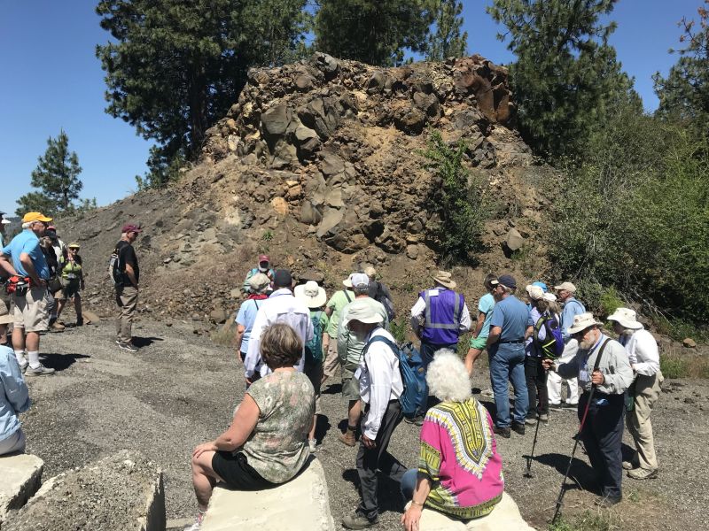
This year’s IAFI June Jamboree delved into the fascinating geological history of Spokane Valley, contrasting it with the iconic Grand Coulee and Dry Falls, explored during last year’s Jubilee. Challenging the Landscape: Unlike the open spaces of Dry Falls, Spokane Valley presented a unique challenge – showcasing evidence of Ice Age Floods within an urban environment. Our chapter tackled this brilliantly, organizing hikes and car caravans departing from convenient public parks and commercial areas. Evening Explorations: The program’s highlights included captivating lectures. Professor Emeritus Dean Kiefer shed light on J Harlen Bretz’s Spokane associates, while renowned naturalist Jack Nesbit brought the story of the first Columbian Mammoth discovered near Latah Creek in the 1800s to life. Celebrating Success: The Jamboree culminated in a relaxed gathering at Mirabeau Meadows. Registrants, leaders, and participants exchanged insights and experiences, with a resounding appreciation for the chapter’s efforts. Comparisons were drawn, highlighting how our Spokane Valley exploration continued the excellence of the Puget Lobe’s outing at Dry Falls last year. A Delicious Finale: The grand finale was a catered Longhorn Barbecue overflowing with delicious food. Everyone left satisfied, with many even taking home doggie bags to savor the flavors afterward. Check out more images from the event in this Google Photo Album. Meet the Masterminds: Linda & Mike McCollum: This dynamic professor emerita and a research geologist duo co-led tours and car caravans, sharing their latest research on the Spokane area’s Ice Age Floods, and shaping the Jamboree’s theme. Michael Hamilton: A gifted geologist, Michael led hikes and the bus trip, encouraging questions and offering honest answers. Don Chadbourne & Chris Sheeran: Don, the chapter treasurer, managed logistics with expertise, while Chris, our media and registration guru, ensured a smooth experience. Melanie Bell Gibbs: A past president and national board member, Melanie oversaw participant check-in and badge distribution. Dick Jensen: Dick handled bus transportation and provided crucial support throughout the Jamboree. Jim Fox: The chapter vice president secured speakers and offered his assistance wherever needed. We also owe a great deal to the participant volunteers who proved invaluable in assisting us in all our efforts. Through the combined efforts of many the IAFI June Jamboree was a resounding success, fostering exploration, education, and a deeper appreciation for the Spokane Valley’s unique geological heritage. Being present with so much information and conversation among such extensive expertise was to witness the scientific process in action. Meeting people from other chapters was particularly nice, putting faces with names we know. We all learned a lot.
Scabland – The Movie, A Google Earth Odyssey

“Scabland” – the Movie, A Google Earth Odyssey “Scabland” is a media complement to CWU Professor Nick Zentner’s 2023-2024 A-Z YouTube geology series that re-treads the ice age floods and the work of Professor J Harlen Bretz and others. In this short animation, viewers virtually fly to a selection of locations visited by geologist Dr J Harlen Bretz, with quotes from his original field notes, geolocated in Google Earth and animated with Google Earth Studio. To see more of these locations, visit https://www.geology.cwu.edu/facstaff/nick/gBRETZ/ This video was done as an experiment/prototype by the authors, Glenn Cruickshank and Eric Larson, to showcase Google Earth, virtual special effects techniques, some of the spectacular landforms caused by the floods, the impacts of ice and water during the Last Glacial Maximum and the field locations of J Harlen Bretz. Eric Larson in Billings MT runs Shashin Studio, a VFX video production company (contact@shashin.studio). Google Earth Glenn is a retired photojournalist and consultant in Liberty Lake WA. Credits: Glenn Cruickshank Eric Larson Two Steps From Hell Made with Google Earth and Google Earth Studio. Thanks to The Families of J Harlen Bretz and Thomas Large, Nick Zentner, Glenn Cruickshank, Bruce Bjornstad, The Ice Age Floods Institute, and many others.
Puget Lobe Chapter Newsreels – A Continental Ice Sheet Background Perspective
(27Jan2024) This post contains the newsreels shown at the bginning of our Chapter meetings. Newsreels oroginally contain: the current presenter, future presenter, Chapter/IAFI current information, and the “newsreel” of selected technical information germane to Continental Ice Sheets. The newsreel after the meeting is then parsed to show just the selected technical information about Continental Ice Sheets. Each chapter describes a certain facet of the history of the ice sheets. These chapters are an exact copy of what was shown at the meeting and are designed to fill the 10-15 minutes prior to the meeting start. Subsequently, the chapters will be revised to add additional subject matter about that chapter subject. And a revision date will be included so you, the viewer, will be able to see the expanded information. You need to click on the links below, then click the little window that shows up to see the synopsis/newsreel: Since it’s a .pdf file, you may have to adjust the size of the page as you scroll through the newsreel on your computer. The current Synopsis is for meeting on: In work intro: Chapter 1 Introduction – Milankovitch Hypothesis 01 Newsreel CH 1 pdf dtd: 29Sep2020 Chapter 2 Earth’s orbital perimeters 02 Newsreel CH 2 pdf dtd: 25Oct2020 Chapter 3 Defining the Pleistocene 03 Newsreel CH 3 pdf updtd: 05Oct2021. Chapter 4 Marine Sediment Cores 04 Newsreel CH 4 pdf updtd: 06Feb2021 Chapter 5 Fraser Glaciation Puget Lobe 05 Newsreel CH 5 pdf updtd: 06Feb2021 Chapter 6 Double Bluff/Possession LGM 06 Newsreel CH 6 pdf updtd: 07Feb2021 Chapter 7 Hood Canal Geology 07 Newsreel CH 7 pdf updtd: 07Feb2021 Chapter 8 Alpine, Cordilleran, Surging Glaciers 08 Newsreel CH 8 pdf 02Mar2021 Chapter 9 Dungeness River, Pillow Basalt 09 Newsreel CH 9 pdf dtd: 01Sep2021 Chapter 10 FS23 Olympic NF, Kame Terrace 10 Newsreel CH 10 dtd: 24Oct2021 Chapter 11 FS2340 and Dennie Ahl Esker field 11 Newsreel CH 11 dtd: 07Dec2021 Chapter 12 FS2340 Outwash Channel/Crag& Tail 12 Newsreel CH 12 dtd: 15Jan2022 Chapter 13 FS23, Rock Creek Canyon, Spider Lake 13 Newsreel Ch 13 dtd: 02May2022 Chapter 14 Port Ludlow Geological History 14 Newsreel Ch 14 See current Synopsis. DRAFT in work – URLs work.
Postmortem on the southern Cordilleran Ice Sheet

(21Feb2024) On 18 March 2924 at 7:00pm the Puget Lobe Chapter io the IAFI will have Dr Ralph A Haugerud give his presentation “the Postmortem on the Southern Cordilleran Ice sheet. Death of an ice sheet can have many causes, as shown by retreat of the southern Cordilleran ice sheet about 15,000 years ago. East of the Cascades, the margin of active south-flowing ice retreated north as less snow fell and more melted. West of the Cascades, the Juan de Fuca lobe of the ice sheet appears to have floated away in response to rising sea level, perhaps without a proximal climatic cause. Collapse of the Juan de Fuca lobe diverted ice from the Puget lobe, which consequently stagnated at its margin and rapidly melted back. Later Sumas ice readvance in the Fraser Lowland may reflect stabilization of the remnant ice sheet by grounding as local sea level fell, followed by climate-driven retreat. Ralph Haugerud received B.S. and M.S. degrees in Geology from Western Washington University and a Ph.D. in Geological Sciences from the University of Washington. Since joining the USGS in 1986, he has worked in the North Cascades Range, the Salish Lowland, and the Columbia Plateau. From 1990 to 2014 he was technical lead for the Puget Sound Lidar Consortium, and he has been instrumental in developing the GeMS standard for representing geologic maps in a Geographic Information System (GIS). His current efforts focus on the structure of Eocene strata in central Washington, features formed by glacial Lake Missoula outburst floods, and regional map compilation. The in-person portion will be at Bellevue College Bldg R, Rm R103. See separate post for location details. For this meeting only there will be NO “Zoom” available.
Puget Lobe Chapter Meeting Location

The Puget Lobe Chapter meets at Bellevue College, Bldg “T”, Room 127, just off I-90. The closest parking lot to the T building is lot 8. There is a cost of $3.00 per vehicle to park. Our presentations are livestreamed on Zoom https://us02web.zoom.us/j/82985244730